By the early 1830s there were plans to move the fort further west; at the same time, the citizens of York were pressing for an addition to the town. The military therefore agreed to survey into building lots and to sell the part of the reserve between Peter Street and Garrison Creek.
Because this was a government-sponsored subdivision, the varied proposals for its layout have all been preserved.
This early proposal (November 1833) centres on a circle surrounded by radiating lots and includes a square and provisions for church and market. Note that the area was planned as a self-contained unit with few road connections to the town.
The properties along the lakeshore and along Lot (Queen) Street had already been sold; the prices and the names of owners were recorded on this plan. Note the higher prices paid for lots along the lake; the area attracted purchasers of a higher social status, in part because of its location near the proposed site for the Government House.”
- Isobel Ganton & Joan Winearls, MAPPING TORONTO'S FIRST CENTURY 1787-1884
With the exception of the Lots on the Bay shore and those on Dundas or Lot street coming under the head of Sections A and C this PLAN is merely a Proposed Sketch of an intended addition to the Town of York. His Excellency not having yet decided upon the Internal Arrangements.
H.J. Castle Dep. Survr. Novr. 26th 1833 Survr Genls Dept York. U Canada
(Lithographed by Samuel Tazewell and described in the Patriot 26 Nov 1833)
Image courtesy of Library and Archives Canada: NMC5035
Winearls, MUC no. 2064(2)
“This (following) proposal for the reserve differs dramatically from the previous one. A simple extension of the town grid has replaced the early innovative design. All streets were to be opened and the land was to be divided into rectangular blocks and half-acre lots.
Note that two earlier burial grounds influenced the location of squares on all versions of the proposed subdivision. The cemetery for the military is still in Victoria Square; that for cholera victims on Newgate (Adelaide) Street was soon replaced by St. Mary's Roman Catholic Church.”
- Isobel Ganton & Joan Winearls, ibid.
Click the image to view a full-size version (PDF).
Government Second Sale of Lots in the City of Toronto May 1834. Commissioner of Crown Lands Office Toronto May 5th 1834. H.J. Castle. Dy. Surveyor 5th May 1834. H.W.J.Bonnycastle del.
Image courtesy Toronto Public Library: T1834-2/4Msm. Winearls, MUC no. 2064(6)
Note: In the original MAPPING TORONTO'S FIRST CENTURY 1787-1884 exhibit, the above caption described a different map, Plan of the Proposed New Town in the Late Military Reserve York, U. C. Henry James Castle Feby 20 1834. (Winearls, MUC no. 2064(4).) Unfortunately I don’t have an image for that plan, and so have substituted a slightly later one; the salient points of the commentary apply equally well to the latter.
For More Maps On This Topic
To view additional maps and history pertaining to the development of the Military Reserve east of Garrison Creek, see here (Fort York and Garrison Common Maps).
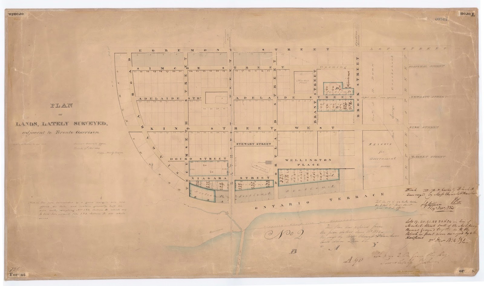
Bonus Map
Who doesn’t love bonuses?
In this third plan selected from the blizzard of proposals for the area (there were 18 in total), we can see some familiar street names cropping up. Another tier of lot auctions would shortly be underway.
Plan of lands, lately surveyed, adjacent to Toronto Garrison. Surveyor General’s office, Toronto 17th Novr 1834, Copy – Henry Lizars.
Source: Ontario Ministry of Natural Resources, Office of the Surveyor General. SR343 H24
© 2014 Queens Printer Ontario
Winearls, MUC no. 2064(7)
Please ‘Like’ and Share these maps with other Toronto history enthusiasts! (+1s are also welcome!)


