- Isobel Ganton & Joan Winearls, MAPPING TORONTO'S FIRST CENTURY 1787-1884
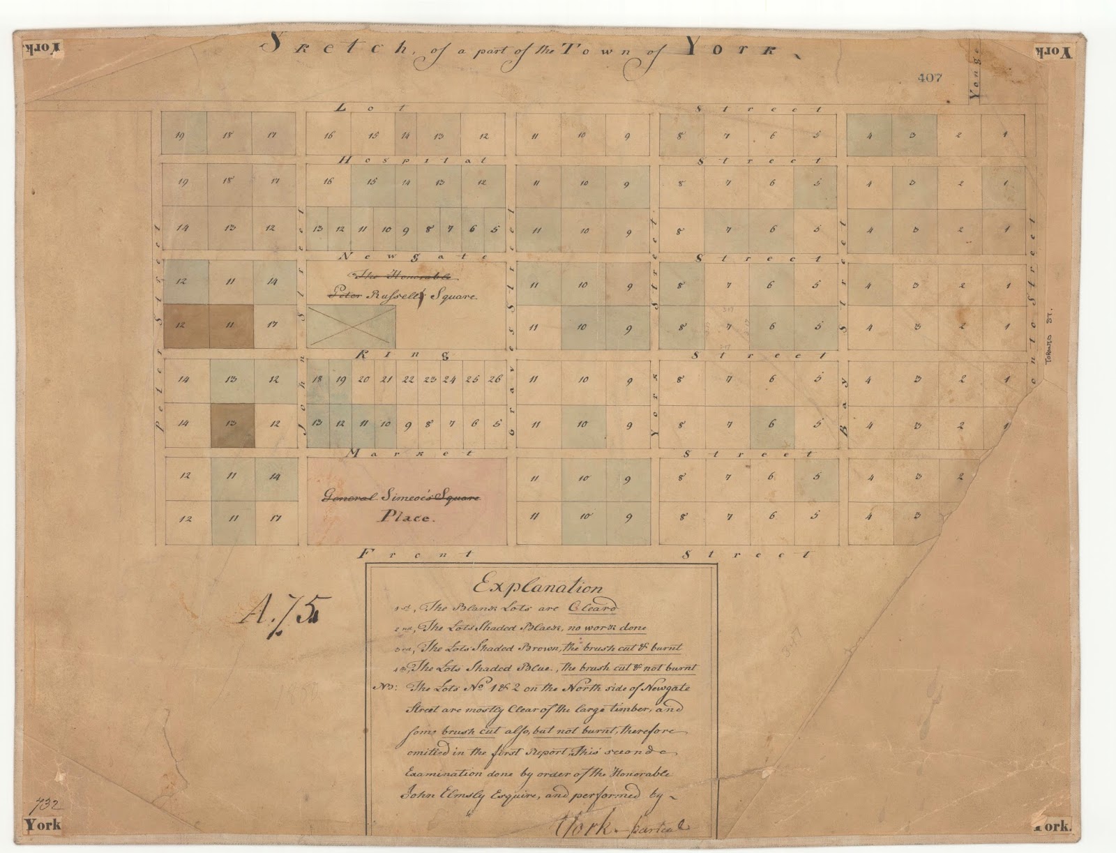
By early 1801, some 77 lots appear to have been cleared or at least had brush cut. The eastern edge of the New Town began one block east of Yonge, at what is labelled Toronto Street on the map, later renamed Victoria. At the time, Yonge St. did not extend south past Lot (Queen) St.; according to Henry Scadding (cf. Toronto of Old), the roadway there suddenly veered eastward, passing down what we now call Toronto Street, a jogging irregularity marking the most convenient route towards the market.
Click the image to view a full-size version.
Sketch of a part of the Town of York ... This seconde Examination done by order of the Honorable John Elmsly [sic] Esquire and performed by [blank] [likely J. Stegmann]. Undated, early 1801.
Source: Ontario Ministry of Natural Resources, Office of the Surveyor General, Plan Ref: SR407 H26
Copyright: 2014 Queens Printer Ontario
Winearls, MUC no. 2026 (1)
The next plan shows the progress in clearing the town lots, with 115 lots indicated as being cleared.
Click the image to view a full-size version.
Sketch of the part of the Town of York West of Toronto Street ... this survey made by order of the Surveyor General’s Office bearing date April the 23rd 1801 John Stegmann
Source: Ontario Ministry of Natural Resources, Office of the Surveyor General, Plan Ref: SR387 H26
Copyright: 2014 Queens Printer Ontario
Winearls, MUC no. 2026 (2)
The enforcement of the clearing order is described in this March 6, 1801 correspondence from Justice John Elmsley to Lieutenant Governor Peter Hunter (a transcript from Firth follows for ease of reading):
 |
| Part of a letter from Elmsley to Hunter, describing the enforcement of the order to clear town Lots. John Elmsley Letter Book |
 |
| From The Town of York: 1793-1815, Edith Firth, p54 |
Please ‘Like’ and Share these maps with other Toronto history enthusiasts! (+1s are also welcome!)


