If proof were needed that the Victorians, just as much as the Georgians, were proud and capable city builders, this bird’s eye view provides it amply. A celebration of their creation, it is a lasting testimony of what had been created in Toronto.”
- William Dendy, Lost Toronto
Click the image to view a full-size version.
City of Toronto
Lithograph by William Nathaniel Wesbroom, 1886 (? see note on dates below)
Toronto Lithographing Company
Image courtesy Ben Hammer/Cartographics. A handmade set of prints based on the Wesbroom lithograph may be purchased from Mr. Hammer here.
The above image is that of the copy held by the Thomas Fisher Rare Books Library at U of T: G3524 .T61 1886. As you can see it has suffered some folding damage and has a few small chunks missing out of it — but it is otherwise at an excellent resolution and you may find yourself poring over the details for quite some time...
The TPL possesses in its archives a more pristine copy (CHPC accession number 975-29 Cab III), which has not been scanned to date [edit: see update below]. I was able to view it in person and took the following somewhat muddy, lower-resolution photograph of the print:
City of Toronto
Lithograph by W. Wesbroom, 1886 (? see note below)
Toronto Lithographing Company
[UPDATE Nov. 2014: The TPL has since done a scan, but I have not been able to obtain a high-resolution version.]
Note regarding dates: Dendy’s Lost Toronto — which uses this bird’s eye view as its cover — gives an approximate date of 1878. Derek Hayes’ Historical Atlas of Toronto indicates 1884. And the catalogue info at the Thomas Fisher Rare Books Library indicates a date of 1886. These may be slightly different prints, or they may be the same and there just isn’t agreement on the actual date...
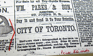
The Toronto Lithographing Company seems to have done especially fine work, wouldn’t you say?
 |
| Advertisement: The Globe, May 22, 1886 |
Lovely.
See Also [Bird’s Eye Views]
1870 Canadian Railway News Bird’s Eye View of Toronto
1876 PA Gross Bird's Eye View of Toronto
1876 Gascard City of Toronto Bird’s Eye View from the Northern Railway elevator
1892 Toronto Railway Company Map Shewing Toronto Street Railway Lines
1893 Barclay, Clark & Co. Bird’s Eye View Chromolithograph


![1886 Wesbroom: City of Toronto [Bird’s Eye View] City of Toronto [Bird’s Eye View], 1886, W. Wesbroom](https://blogger.googleusercontent.com/img/b/R29vZ2xl/AVvXsEjF1Q7p2QHTVnXhv7_OrPhYv6Qs9cYDMFHB0k1fDltGFKo7CaAk1jMU6VsWuR7CUHSPh60d3dBvkOmzEd-V1zJYp0bvalxlFibqG1kVPi8Ix_OXVANHQKA979Qwm6NM7bMVfdJEWhvep0oM/s1600/1886WesbroomBEVsm.jpg)

